Saturday, 26 December 2015

Middle East Meltdown

(source)


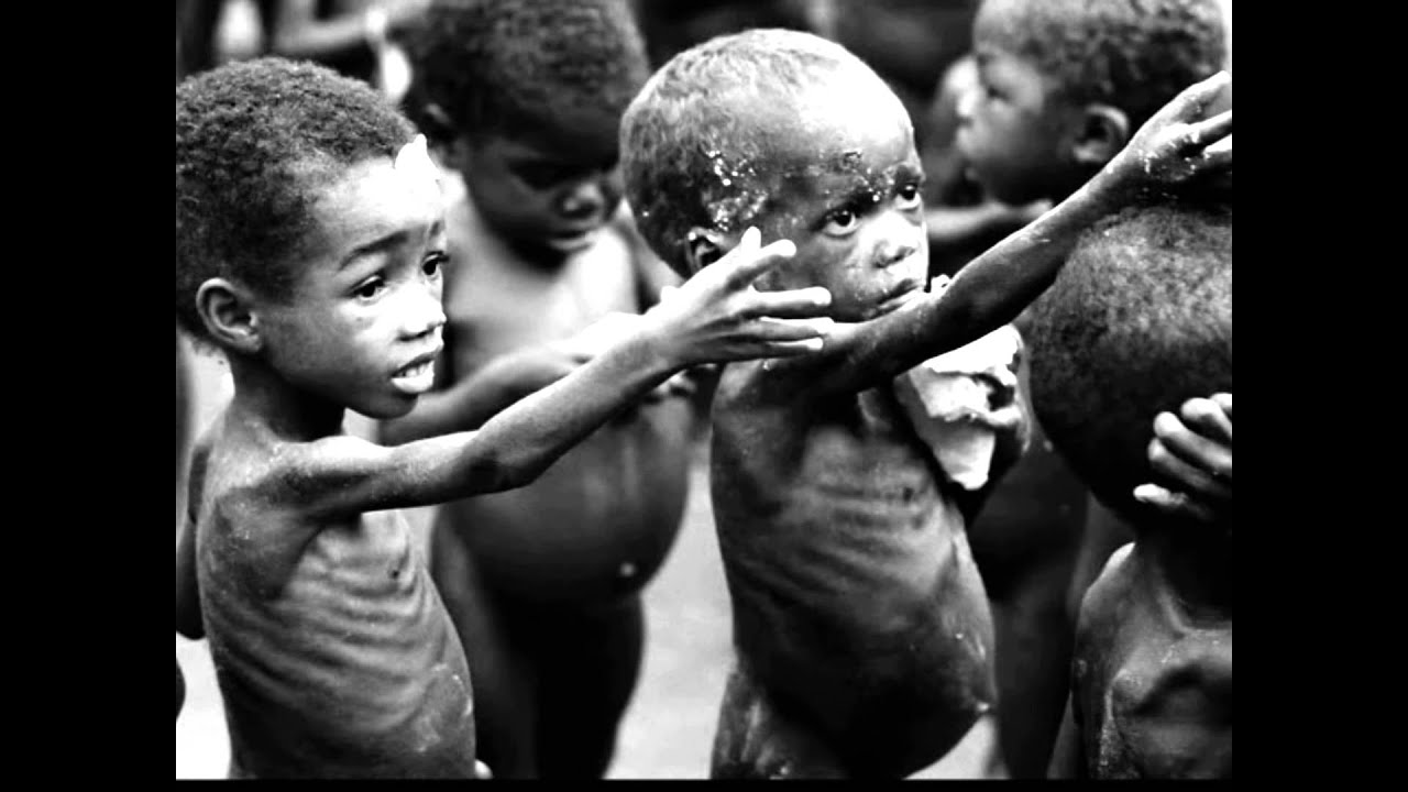
Under a 'business-as-usual' scenario, a recent study suggests that the region around the Arabian Gulf in the Middle East could become inhospitable for human life by the year 2100. To define a threshold to mark the climatic conditions tolerable by a fit human, Pal and Eltahir (2015) used a 'wet-bulb temperature' measure. This is a combination of temperature and humidity which is used to define the survivability of humans under certain climatic conditions. It is believed that the fittest human could last for up to six hours in a wet-bulb temperature of 35°C. The recent study published in Nature used an ensemble of high-resolution climate models to project future wet-bulb temperatures and found a specific regional hotpot in the region of the Middle East (figure 1). In July 2015, temperatures reached 34.6°C in Bandar-e Mahshahr, Iran for around an hour, extremely close to the 35°C wet-bulb temperature threshold identified as being fit for human survival. As the global surface temperatures continue to increase into the future, high evaporation rates from the Persian Gulf will increase humidity across the region. Furthermore, it is a region of low elevation and clear skies, conditions which makes the Middle East a hotspot for extreme conditions. Under the 'business-as-usual' IPCC scenario, this study suggests that the Middle East could see the 35°C threshold exceeded by 2100, making the region inhospitable for human life and driving major migration of people from the region. 

This is a region with an ancient history which supports some of the world's earliest civilizations in Mesopotamia and the Fertile Crescent. It is the birthplace of many religions including Christianity, Islam and Judaism and a diversity of cultures and societies. Today, the region supports many of the world's major cities including Cairo (Egypt), Istanbul (Turkey), and Baghdad (Iraq). This study shows how the impacts of future climate change could have disastrous consequence for the societies inhabiting the region by 2100 by increasing threat to water and food security, driving a substantial rise in climate refugees from this region and a significant change to the world's demography. 


Figure 1: Spatial distribution of extreme wet-bulb temperatures (a, b, c) and extreme temperature (d, e, f)  for each historical GHG concentrations (a, d) and for representative concentration  pathway RCP4.5 (b, e) and RCP8.5 (c, f) (source). 

Sunday, 20 December 2015

Climate change six years on


Figure 1: Maria Mallik, Bangladesh (source)
Back in December 2009, the Observer published an article describing the lives of the families of four new-born babies from different corners of the world and their struggle to cope with the impacts of climate change. They recently returned to meet those children to see how their lives have changed in the last 6 years. This is the generation which will feel the greatest impact of the actions of today’s society.
The father of Maria Mallik has been a rickshaw puller in Bangladesh for 30 years, but today the rising temperatures and increasing pollution is making him weak. On top of this, the family of seven live on the coastal outskirts of the city in Barguna district, an area which has seen a significant rise in sea levels due to global warming over the last few decades. When the sea floods onto agricultural lands, this increases the salinity concentration and destroyed the productivity  of the lands, pollutes the drinking water and destroys homes. The last decades have seen an increase in intensity and frequency of cyclone and storm surges which case widespread damage to these coastal regions. Coastal erosion is driving more and more people to migrate away from these areas. Maria’s father explains how the community are well aware of climate change and the effects are felt on a daily basis -  “everyone in our community now knows that climate change is now a big threat. Everyone is tired of speaking about it. We are poor so there is no way out.”.

Figure 2: Denislania da Silva, Venezuela (source)
Denislania da Silva is a six-year old member of the indigenous Macuxi people who’s homeland is around Barro, Venezuela (figure 2). In 2009, their lands were threatened by multinational companies who wanted to turn their marshlands and key hunting grounds into rice plantations to feed the growing world population. A few years ago, the Brazil supreme court has rule in favour of the Macuxi, and that the lands should stay in their hands.  But today, the Macuxi face a different threat. The effects of climate change has been felt in this region as the climate is becoming drier, temperatures have increased, and an increase in threats to water security. Seasons have become less distinct, weaker rainy seasons and warmer dry season causing water reservoirs to dry up. Denislania’s mother recalls - “Our river used to be abundant but it’s suddenly dried up. The fish that we used to catch have disappeared. Even when there is only rotten old fish, people will buy it. Our wildlife is also leaving – all because of the drought. I sometimes wonder if God is making us die from drought.”

Figure 3: Olomania Mutonka, Kenya (source)
Back in 2009, the family of 6-year old Olomania Mutonka were fearful of the future as droughts were threatening their very survival in the outbacks of Kenya (figure 3). No rain has fallen for a year, cattle are dying, and food and water security is reaching levels of extreme desperation. An increase in the intensity and frequency of drought events has been observed in this part of Kenya over the last few decades as was explored in a past blog, and by 2020, 75 million people are predicted to suffer from water stress in east Africa. Today, Olomania’s mother travels for six hours to collect water, a journey which she must walk every other day, and this water is from an old, abandoned quarry that contained toxic, salty water. She says - “If the drought continues all our animals will die and we will be left with nothing. We will have no money to pay our children’s school fees. The Olkejuado river dried up a long time ago and so we have nowhere else to fetch water from. That is what we have to drink.”

Figure 4: Fretelina de Oliveria, Timor-Leste (source)
Fretelina de Oliveira lives in Au-Hun on the island of Timor-Leste (figure 4). “Six years ago the climate was better, normal and not as hot as it is now” says Fretelina’s father. Over the last few decades, the island has been hit by numerous drought events and an increase in temperatures, significantly decreasing the productivity of the islands main agricultural product, maize. During the dry season the hot climate has made life ‘life unbearable’. But during the rainy season, a dramatic change is seen as the village is devastated by floods and heavy rains. The seasons are ‘erratic’, and as temperatures continue to increase in the future, the intensity of the hydrological cycle will also continue to increase.
 These are the stories about four children are the struggle of them and their families as they battle against the ever increasing effect of climate change. Societies today are feeling the effect. Let hope that in the near future that these stories will not develop into stories of societal collapse.

Saturday, 19 December 2015

Climate and the classic Mayan collapse

Figure 1. A Mayan temple (source)


Every year, thousands of tourists flood to Central America to visit the ruins of the ancient Mayan civilisation. The pyramids, temples and monuments, which are today entangled in thick jungle vegetation, are only a glimpse of a once fruitful, sophisticated civilisation which possessed the knowledge of astronomy and mathematics, and crafted beautiful jewelry out of obsidian and jade. At the peak of their success, the Maya population in the Yucatan Peninsular, reached 13 million around 750 A.D. By 950 A.D, the population had significantly declined and their city, falling into ruin, was left in the hands of the jungle once again. To this day, this 'terminal Classic collapse' story remains a great mystery as to what drove the collapse of this successful, ancient civilization and this blog aims to explore the role of climate change in driving this collapse.

Haug et al. (2003) claims that the key behind this collapse story, lies in the geographical location of the Yucatan Peninsular. The Mayan lands fall between 17-22*N and is a seasonal desert receiving 90% of its rainfall between June and September, with a pronounced dry season throughout the rest of the year. Its rainfall patterns is driven mainly by the movement of the Intertropical Convergence Zone (ITCZ) which moves northwards in the summer bringing rain over Central America, and vice versa in the Winter months. As a result, the Maya built massive, sophisticated drainage systems throughout the cities, reservoirs on hilltops which used gravity to distribute the water, and complex irrigation systems.  They were highly dependent on the movement of the ITCZ to replenish their freshwater supplies; a failure of this climatic phenomena could potentially have been catastrophic.

Haug et al. (2003) and later Peterson and Haug (2005) measured the concentration of titanium and iron elements from lake sediments and used them as a proxy for river discharge and changes in the hydrological cycle. They noted a long period of extended drought across Central America with multiple punctuation of intense drought periods centered around 810 A.D, 860 A.D, and 910 A.D, coinciding with the collapse of the Maya (figure 2). Peterson and Haug state that the significance of this discovery show how tightly couples the collapse of the Maya was to environmental constraints.

Figure 2. The titanium concentrations from the lake sediments identifying the terminal Classic collapse as a possible driver of the Mayan collapse (source)

Diamond (2005), described the collapse as an 'ecocide' and suggests that the society destroyed the environment which the depended upon and essentially causing their own collapse. Environmental degradation is being highly blamed by Diamond as the Maya damaged their lands through intense agricultural practices including terracing, irrigation, deforestation and draining field. Over-reliance on a maize monoculture, a humid-climate which prevented the long-term storage of food, a lack of domesticated animals to aid with agriculture and a protein-poor diet, were also contributing factors, as was the lack of friendly neighbours and the highly structured, unequal, social hierarchy (Diamond, 2005).


This view by Diamond has been highly criticised, as many authors claim this view to be an environmental deterministic view. This is a concept which suggests that the physical environment sets a constraint on societal development, a concept which as Coombes and Barber (2005) show, has received much criticisms. It is seen as shifting the blame and responsibility behind collapse stories away from humans and onto a factor beyond our control. Furthermore, they claim that palaeoenvironmentalists are too ready to blame the collapse of a civilisation on climatic change solely based on an apparent correlation in the proxy record.

Hodell (2011) further this by stating an argument by highlighting the weaknesses of palaeoenvironemntal studies. The poor resolution and the inaccuracy in dating records are among the few factors contributing to the uncertainty and ambiguity in palaeoenvironmental records. As Aimers (2011) states, palaeoclimate data must be interpreted with care and the evidence is not robust enough yet to blame the collapse of the Mayan civilisation on climate change alone. A greater collaboration between climate scientists and archaeologists is needed (Aimers, 2011).

Collapse may not be the correct term to describe the decline in population or the abandonment of the Maya cities, as an increase in population was seen in other regions in Central America which suggests that some of the Mayan migrated away from these marginal areas to rehabilitate elsewhere (McAnany, 2010). It is clear that we cannot blame one single factor on the collapse of the Maya civilisation but that it was possibly due to multiple, cascading factors - an unstable society pushed by climate chang across their threshold and beyond stability. Although a dramatic depopulation did occur in some regions, seven million decendants of the once great Maya civilisation continue to live in remote villages across Central America. It was certainty not a complete obliteration (Gause, 2014).

Thursday, 17 December 2015

When the sea took the land

A previous blog titled 'Melting Away' has been written on how the temperatures in the Arctic are increasing at a rate higher than the global average and on the consequence of climate change on societies today living in the Arctic circle. As a more recent development, on December the 15th, the National Oceanic and Atmospheric Administration (NOAA) issued a press statement stating that "the Arctic is warming twice as fast as other parts of the world". Extensive melting was mostly observed in parts of west Greenland, northwest Alaska, and Baffin Bay, and a 5°C increase in temperatures above the average was measured in some areas during 2015 (figure 1). The report presented statistical description of the observation for the Arctic region for the year 2015 and amongst the key findings were:
  • average Arctic temperatures  were seen to be 2°C warmer than the global average
  • minimum sea ice extent for September was 29% less than the average
  • maximum sea ice extent occurred 15 days earlier than the average
  • maximum sea ice was 7% less than the average
  • snow cover has decline 18% per decade since 1979
  • a substantial increase in green vegetation already seen to respond to the warmer climate
  • a noted change the habitat of walruses and subarctic fish


Figure 1: A map and a graph demonstrating how the temperatures across the Arctic are increasing above the average rate (source)

A documentary which might be of interest to some of you follows the story of an Arctic village, Kivalina, northern Alaska, as erosion of the land by the force of the sea is threatening their village. The documentary shows how in the past thick sea ice protected the village from the impacts of sea waves. Today, the rising temperatures have melted the sea ice and the soft land is crumbling into the water and the waves hit the shores. A short trailer can be view below, and the documentary itself is airing this Sunday at 9pm on Al Jazeera.


Wednesday, 9 December 2015

Reversing desertification

Figure 1. Desertification in Oman (source)


Desertification is land which is turning into desert and approximately two thirds of the land on Earth is desertifying (figure 1). It has destroyed many societies in the past, and is causing great problems to societies around the world today. It occur when soil organic matter is stripped away to reveal bare, hard ground which leads to increased runoff and evaporation. Furthermore, the decomposition of the soil organic matter releases carbon to the atmosphere which is changing the microclimate in the short-term and the macroclimate in the long-term. 

Societies around the world have been taught over recent decades that desertification is caused by overgrazing by livestock and as a result, large groups of livestock has been discouraged. In the 1950's Allan Savory, Zimbabwe's land degradation expert, suggested that in order to reduce and reverse the widespread problem of desertification in their national parks, the number of elephants in the park must be reduced. This led to a massacre of 40,000 elephant in order to bring their levels down to a level the land could sustain. Today, Savory admits that 'it was a terrible decision' as the problem of desertification over the following years got worse, not better. In Savory's words - ‘We were once as certain that the world was flat! We were wrong then and we are wrong again!’.


In a recent Ted Talk video, Savory presents evidence challenging the idea that livestock cause desertification. Due to evolutionary pressures from predators, grazing animals have developed to form large packs of herds. These herds are continually on the move, looking for new vegetated lands, and it is this movement that prevents overgrazing. Savory proposes, that there is only one option left to recent desertification - "to use livestock, bunched and moving, as a proxy for former herds and mimic nature. There is no alternative left for mankind.". 

Societies are now encouraged to use holistic management and planned grazing process to reduce desertification. Today, there are people who are teaching farmers in societies across the world how to plan and manage their herds. They are being encouraged to keep their animals in pens overnight to prepare crop fields and significant increase in crop yield has been seen. To compare, we see lands in Zimbabwe previously subject to desertification (figure 3) which have seen dramatic change since the introduction of the holistic management and planned grazing process and increasing the number of herb grazing animals by 400% (figure 3). Furthermore, increasing the vegetation will allow carbon from the atmosphere to be stored in grassland soils and vegetation and in the long-term this could help prevent global warming. 


Figure 3. Lands in Zimbabwe in before and after planned holistic management was used. 

Today, we see societies turning to using this low-cost method of planned holistic management since it is the last hope that they have of saving their families and saving their cultures. Desertification is causing hunger, poverty, social unrest and wars and is playing a significant part in global climate change.  Planned holistic management and moving herds of livestocks mimicking nature is suggested by Alan Savory as a critical technique to reverse desertification. 

Monday, 7 December 2015

A greener future


Figure 1: A young Sahelian farmer tends his garden (source)
The brave 2 million inhabitants of the Sahel region in Africa have faced sever prolonged droughts in recent decades as was explored in the last blog. Since the 1960-1980's drought-period, societies have attempted to reclaim their land by stabilizing sand dunes, cultivating trees, building rock walls to stop erosion, and sowing seeds in pits which have been dug to catch rain (figure 1, 2). Advancing on this, new studies are emerging which suggest that global warming could bring a glimmer of hope of a wetter, more tolerable climate. Issues regarding desertification, water and food security could be made history claimed the Guardian, as future climate change could stop the drying of the Sahara. Already, scientists are reporting an increase in rainfall and the regreening of the Sahara. 

Figure 2: Sahelians fence sand dunes to prevent erosion (source)
 Haarsman et al., (2015) created a climate model of the Sahel region and simulated the effects of global warming under different representative concentration pathways (RCP) between 1980 and 2080. A significant increase in rainfall within a couple of decades was found and the study reports that the increase could strongly reduce the probability of future prolonged droughts. The mechanism behind the changing climate in the Sahel region is analogues to the polar amplification in the Arctic which is causing significant increase in temperatures above the average global rate. Cook and Vizy (2015) reports a substantial increase in Sahara surface temperatures at a rate of 2-4 times greater than the average tropical increase over the last 34 year period. Global warming will increase land temperatures sooner than ocean temperatures. While the warming across most of the globe involves the full depth of the atmosphere, the warming in the Sahel region is concentrated at the surface since the dryness of the desert is limiting the longwave radiation, changing the air pressure and the weather.

Already, in the southern Sahel, the band of rainfall has moved northwards at a rate of 9 km per year since 1982. Dong and Sutton (2015) present observed data of a 0.3 mm increase per day in rainfall since 1996 against the average for the 1964-93 period. They suggest that the recovery of the Sahel rainfalls to the levels pre 1960-1980 drought-period is a response to anthropogenic greenhouse-gas and aerosol forcing, and they predict that the recovery is likely to be sustained or amplified in the near-term. Satellite images from AVHRR (Advanced Very High Resolution Radiometer) sensors demonstrate how the vegetation cover in the Sahel is responding to the change in rainfall by expanding northwards by 3 km per year (figure 3). Animals which have not been seen in some regions over the last few decades are returning such as gazelles and ostriches to some areas of Morocco.

Figure 3: The same area in 1975 (left) and 2005 (right) in southern Niger (source)

National Geographic (2010) interviewed Stefan Kropelin, a climate scientists who has been studying the climate of the Sahara region for decades and he stated how in recent years shrubs are expanding and different species of vegetation are appearing (figure 4). Kropelin states "the nomads there told me there was never as much rainfall as in the past few years. They have never seen so much grazing land. Before, there was not a single scorpion, not a single blade of grass. Now you have people grazing their camels in areas which may not have been used for hundreds or even thousands of years. You see birds, ostriches, gazelles coming back, even sorts of amphibians coming back.”.

Figure 4: Sahelian women tending their shrubs (source)
Desertification, drought, famine and conflict are the usual stories that are entangled with future global warming. Yet, the accumulating scientific evidence and the stories which are coming directly from the people living at the forefront of climate change in the Sahel are indicating a different scenario, a blossoming, regreening Sahara and possibly a more fruitful future for the societies of the Sahel.  


Sunday, 6 December 2015

Do they know it’s Christmas?

Figure 1. The Ethiopian famine of 1983-85 (source)

Over the upcoming weeks, there will be no escape from the successful Christmas hit written by Bob Geldof and Midge Ure back in 1984 “Do They Know It’s Christmas?”, a song which  was written for the Live Aid concert as an urgent response to the widespread Ethiopian famine (figure 1). The famine was driven by a decade of serve drought and civil war which claimed 400,000 deaths in Ethiopia alone, spreading across east Africa and north into the Sahel region. Figures by the UN estimate a total of over one million deaths during the 1983-85 droughts. Over 50 million people in the Sahel region were estimated to be affected form the period between 1960-1980 - a period characterised by an increase in the frequency of droughts and famine on a massive scale effecting. This period saw a dramatic shrinking of Lake Chad to 95% of its original size between 1963-1998 effected over 20 million people in four countries who were highly dependent on the lake as their main source of water.  More recently, drought-induced famine hit the region again in 2010 and 2012 resulting in widespread food and water insecurity, increase in deaths, illnesses and malnutrition, and economic and political instability. This blog will explore the role of climate change in driving these drought events. 

Rains reach the Sahel during the West African Monsoon summer season with the majority of this highly erratic rain falling between July-September. Rains are also driven by tropical convection and the formation of towering thunderstorms, and El Nino events during the abnormal warming of the Pacific Ocean. Research by the Joint Institute for the Study of the Atmosphere and Ocean (JISAO) at the University of Washington suggests that the Sahel region has been in a period of unusually dry years since the 1960’s as a deficiency in rain, indicated by downward bars in the graph below (figure 2), has occurred for most years since the late 1960. As the graph shows, the most severe drought was that of the 1980’s, corresponding with the Ethiopian famine of 1983. Many factors have been proposed to explain the recent drought period yet the cause of the droughts is still an ongoing debate.

Figure 2. Sahel precipitation anomalies 1900-2011 (source)

In the 1970’s, the Sahelian farmers were blamed for the caused of the widespread drought and famine. Environmental problems including overgrazing, deforestation, over-using natural resources and poor land managements as a result of incorrect agricultural practices by the Sahel farmers was believed to be the main driver. As suggested by Taylor et al., (2002), the expansion of farmers to marginal areas due to over population and an increase in food and water demand was believed to cause a reduction in vegetation coverage which inevitably led to less rainfall. However, recent studies disprove this idea and the extent at which these environmental factors could trigger a widespread, multidecadal drought has been questioned as explored by Mantell (2003).

More recently, evidence is accumulating in favour of climatic triggers. Kerr (2003) proposes that the warming of the Indian Ocean, which has been shown to dramatically increase the land temperature across Africa with temperatures reaching 3.5*C in Niger, could have occurred during the 1960-1980 drought period resulting in water shortages and harsher regional weather At the end of 1900’s, rapid warming of surface ocean temperatures may have reduced the difference between temperatures on land and sea, causing a weakening of the monsoon. Zhang and Delworth (2006) proposed another possible natural climatic driver and that the Atlantic Multidecadal Oscillation entered a warming phase which peaked in 1950 and influenced the atmosphere the following decades. 

Figure 3: Extreme drought which hit Africa between 1960-1980 (source)


Ackerley et al., (2011) proposes that anthropogenically-induced climate change factors have also been a key driver. Global dimming and the widespread air pollution and aerosols can cause a change in the properties of clouds over the Atlantic Ocean and the blocking of incoming solar radiation, and this has been suggested to have disturbed the monsoons and shift the tropical rains southwards and away from the Sahel region. Ackerley et al., (2011) stats that historic aerosols level were modeled and seen to be a key driver behind the 1960-1980 drought. Contradicting this study, Haarsma et al., (2005) states that the recent global warming as a result of the increasing greenhouse gas concentrations in the atmosphere, did not play a part in driving the drought, and is more likely to cause an increase in rainfall in the Sahel region in the future, and this has already been observed since 1980’s by Wang and Gilles (2011)This will be explore in future blogs. 

Once again, we see the complexity of understanding and pin-pointing the main drivers behind extreme climatic events such as the drought period which hit north and east Africa between 1960-1980. Natural multidecadal climatic variability driven by the change in the sea surface temperature of the Indian Ocean and Atlantic Multidecadal Oscillation may have initially triggered the droughts, but environmental and social factors including poor-agricultural practices and overpopulation enhanced the climatic effects resulting in widespread droughts which led to substantial social instabilities, deaths and conflict. 


Tuesday, 1 December 2015

Green Sahara

Figure 1: An oasis in the Sahara desert (source)

The Sahara is the world's largest hot desert. Comprising most of the land found within North Africa it stretches from the Red Sea in the east to the Atlantic Ocean in the west. As one of the regions with the lowest population density on Earth, fewer than two million people populate the Sahara today (Hogan et al., 2014). Yet, this has not always been the case as Manning and Timpson (2014) shows how the population of the Sahara expanded between 10,500 and 5,500 years ago. Once again, climate change has been indicated to play a part in the history of human survival in the Sahara. 

In 2008, a team of palaeontologist set out on a trip to hunt for dinosaur bones to the Ténéré desert, northern Niger, on the southern flanks of the Sahara, and their story was detailed by Gwin (2008). Today, the landscape of the Ténéré is barren with rolling sand dunes and average summer temperature can reach 40°C.  Sereno et al. (2008) details how instead of finding dinosaur bones, they came across a Stone Age graveyard full of human bones! Among the sand dunes, they found clay pots, beads, stone tools, arrowhead; a clear evidence of a Neolithic society. They found bones of water-loving animals including the bones of crocodiles, hippos, turtles and fish which today are found nowhere near the dry, barren region - evidence indicating a possible palaeolake. Rock engravings were found with images of animals and vegetation, indicating a lush, greener region (figure 2). In addition to this, it came clear to the archaeologists that the human bones were not of the same age. The earliest bones belonged to the fishing-based Kiffian tribe, dated between 10,000 and 8,000 years ago, which indicates a wetter climate when the Kiffian occupied the region. The youngest bones belonged to the nomadic, herding-based Tenerian tribe that occupied the region a couple of thousand of years after the Kiffian disappeared, between 6,500 and 4,500 years ago. Some of the Kiffian skeletons reached 6 foot 8 inches in height, were thick-bones and well-muscled as is expected of a strenuous fishing life.  In comparison, the skeletons of the Tenerian tribe appeared were smaller, and some of the skeletons were laid to rest on a bed of flowers as indicated from the presence of pollen. Clearly, between 10,000 and 4,500 years ago, regions of the Sahara desert was lush enough to sustain a fishing culture which transitione to sustaining a herding lifestyle. But after 4,500 years ago, this region of the Sahara could no longer sustain life, and the tribes vanished. 


Figure 2: a rock engraving with an image of a giraffe, an animal which today cannot survive in this region (source)

Gasse et al. (1990), and many other studies identify, an African Humid Period (AHP) approximately 12,000 years ago marking a change into a lush, vegetated Sahara which terminated 5,5000BP. This is also referred to by Sereno et al. (2008) as the 'Green Sahara'. The mechanism behind this transition to a dry Sahara is still debated, yet three potential mechanism have been proposed to solve 'The Green Sahara problem'. Firstly, Berger (1978) suggests that it occurred to due orbital forcing which caused the Earth to be closest to the sun in the Northern hemisphere in the summer and a significant gradient difference between the equator and the poles to form, pushing the ITCZ and the rains northward across the Sahara during the AHP. A recent paper by Shanahan et al., (2015) supports the work of Berger and demonstrated that a change in incoming solar energy caused an abrupt collapse of the African Monsoon, terminating the AHP. Secondly, Charney (1975) suggests that a decrease in vegetation cover cause the termination of the AHP by increasing the difference in albedo between the Sahara and the oceans, strengthening the zonal circulation winds and decreasing the rainfall across the Sahara. A more recently proposed theory is that of Swann (2014) which suggests that the decline in forests across Europe caused a southward shift in the ITCZ and altered precipitation patterns. Understanding what happened during this period might be useful to see how the Sahara region, and other deserts across the world, might react to future climate change. 

How this climate change and ecological transition effected the human occupant of the Sahara during the Holocene has been explored by Manning and Timspon (2014). By studying 1101 archaeological sites, they demonstrate a major shift in human behaviour and population between 10,500 and 5,500 years ago corresponds to the African Humid Period (figure 3). The paper admits that the lack of available palaeoclimate data and the assumptions and limitations associated with palaeoclimate proxies question the reliability of the correlation test and the uncertainty in the findings. Timing issues arise between the demographic shift in 11,000BP and the increase in aeolian dust in the sedimentary record at 12,500BP, and this temporal delay questions the understanding of the interplay between humans, the environment and the climate. Nonetheless, this study, along with many others, show how climate change was the prime driver behind the demographic shift and the major collapse in population 5,200 years ago. Understanding the timing and nature of this change in the Sahara has major implications for understanding the links between climate change and human population today. 


Figure 3: still frames from a model simulating the population density across the Sahara between 12,700 and 2,900 years ago.
 An exponential increase is seen between 10,200 and 7,500BP and a rapid decrease is seen between 4,900 and 2,900BP. (source)